Wednesday, 21 December 2011

Going back home...

We left several hours after the hike. We decided that we wanted to have time to enjoy our Sunday as I had to get back to work the next day ... nonetheless, we had a great time!
Sasha was enjoying the scenery as well!

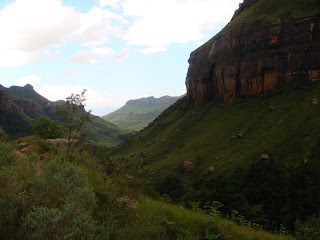
The rest of the pics were taken by Steph. They are an attempt to capture some beauty of this region... it was a trip worth making...hope you enjoy...


Warm up

After we ate, we went to the Royal Natal Park to scope out what we wanted to get done the following day. It was an easy drive about 10 minutes from the rondavel.

This is the water that flows down from the top of the Berg and is the source of water for the locals. It is pure mountain spring water. Clean and safe to drink.
We saw about 5 baboons, and no, we did not feed them.


So, we went to the Park's visitor center to pick out a trail to hike. We selected the most common hike to the base of the Tugela Falls. The hike is about 13 km which was estimated to take about 5 hours! We then headed back to the rondavel at the Tower of Pizza, but we stopped to pose by this beautiful site. The mountain range behind us is called "The Amphitheatre."


The ride back was just great. Above you see where the locals live. They may not have running water or electricty, but at least they live in beautiful, big-sky country!


Local kids playing a game of pickup soccer on a Friday evening.


The following picture was taken the next morning on our way to the parking lot to base of the hiking trail. Our hiking trail would take us up to those clouds.

Good thing we had all the gear we needed.


The Berg!

At the start of our hike, the Park requires that we complete a "who-to-notify-if-you-don't-make-it-back-form." I got a bit nervous about that, despite having hiked numerous times before. We filled out the form, and the Park attendant said thanks and enjoy!

There is the map!
At the trail's entrance. We were psyched and ready for the challange!


Of course, when you start the hike you take a ton of pictures. Here are some pictures early on!
This is the river at the beginning of the hike. Soon you will see how far up we went!


Still early on in the hike. To the right you can see that we are starting to ascend! Steph's ready to go!


Part of the trail takes you through some shady forested areas. It was a nice relief from the intense sun, but overall, the weather was perfect!

We were getting closer to those clouds!

River runs through it....

After this point, it was all uphill. Man, was it tough.


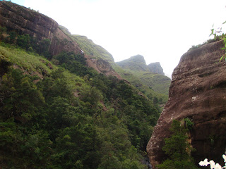
More wonderful views ...


The protea flower very common in this region, and we passed through a valley filled with protea flowers.

This appears to be a golden dandelion, and it really has a gold sheen to it. Simply amazing.


We had to traverse around those two lower mountains to make our way up!


Steph was a trooper! She was amazing on the hike and kept me going.


The path continues!


There is the river below us...we are getting higher!

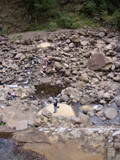
This point of the trail is called the "boulder-hop." The gorge is just beyond this quarter mile of boulders. Can you say, "Oh, that's why they make you sign a waiver?"

Walking along the river was extraordinary.


We finally arrived...


Here is where you separate the men from the women....


So Steph went up the 20 meter chain ladder! I stayed behind because I didn't think I would be able to grip the ladder. In my defense, I had a swollen finger from trying to replace a lightbulb at our house the day before (don't laugh).
Just evidence to show I had made it :)


This is a picture from the top taken by Steph. You can ascend this rock wall by climbing a seriously tight squeeze fissure. Behind it is a natural pool.


Here is the view Steph had from up there. That's me down there rubbing my swollen finger :-)


On the leftside of this picture, you can just barely make out a small wooden ladder which we climbed to see the waterfall.


We soaked up the scenery for a bit, had some snacks, and went over to the waterfall.


If you go through the cave, you can also swim under the waterfall.

Here is a view of the waterfall...


After taking in the wonderful scenery up at the top, we knew it was still going to be a hike back down. So, we got started...


We enjoyed the hike, and afterwards, I was sore as heck...Steph was fine :)


Eating at the TOP

After I woke up, we headed to the restaurant on the grounds. There is indoor and outdoor seating. We decided to sit outdoors because it was a really beautiful day! Here is a pic of Sasha catching the attention of the diners at the table next to ours.

Obviously, as with most places we take Sasha, everyone fell in love with him. Naturally, he loves the attention and plays the "I'm so neglected please pet me" part for them! So he went table to tables saying "hi" to all! "Mooi" is the Afrikaans word for "beautiful." So, when we tell people here that Sasha is a Samoyed they say oooooo... mooi... :)
We took our seat and were waiting for our food!!
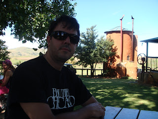

Behind me stands the "Tower" of Pizza.

Did we mention that Sasha was a hit with kids too....very cute!


I just could not resist taking a photo of him on the trailer!
Oh ... yes, the pizza was top notch!!!!

Headed to the Drakensberg

We left for the weekend to visit the Northern part of the Drakensberg (which roughly means Dragon Mountain). It is the highest mountain range in South Africa (just over 11,000 ft), and we were set to go to the Royal Natal National Park to do some hiking.


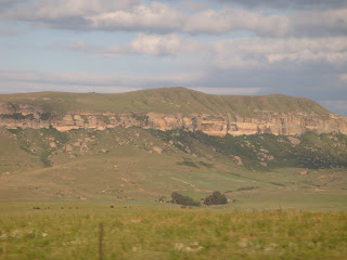
Here are some of the first images of various mountain ranges within the Kwa Zulu-Natal province.


The views were simply stunning, and these pictures don't do it justice!

The ride was pretty smooth for most of it (total time there was 4 hrs & 30 min), but the last 20 miles was pretty rough. We came to a large back-up on the road ....
and then realized that the main road to get into the park is under construction. Only one lane is available, and even this one lane was pretty bad (pot holes, ditches, etc.). I suppose not as bad as parts of old Lower Wacker Drive or even certain parts you would now find on the west side of Chicago. Bad nonetheless, this took about 1 hour to get through.


We were getting close and saw what appeared to be a lake but was in fact a resevoir of a dam.


These views from the road were magnificent! We were getting excited because we had finished off the bad part of the road and were picking up the pace.

As we kept driving, we realized how massive the area was. It's not as big as the Grand Canyon, but it is similar.